

Dispatches from the Road, Pt. 6
Dispatches from the Road, Pt. 6
Visions of America: Eastward

Gentle reader,
Our last Dispatch covered the road west across the bottom of the country, then the route up the West Coast, selecting some strange sights and sounds along the way. Today’s will pick up where we left off, in the northwest, and send eastward across the top of the country. If you’re having trouble visualizing all this, here’s a semi-accurate map that was recently brought to our attention:

Eastward
The Great Basin
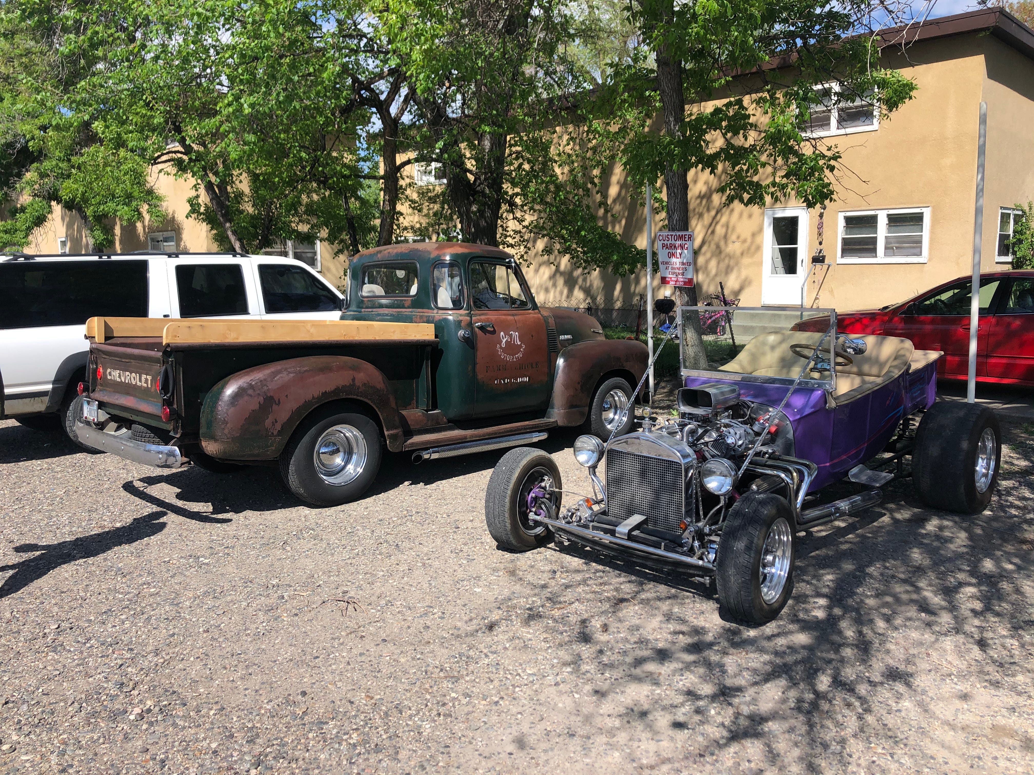
At their eastern edges, the Cascade Range (Oregon) and the Sierra Nevada (California) give way to the Great Basin in one of the most dramatic shifts anywhere in the country. You pass through high snowy pine peaks and descend into a huge arid region covering the eastern edge of California, southeastern Oregon, western Utah, and nearly all of Nevada. You leave behind Bend, Tahoe, the mountains, people, civilization, and the rest of it, look down the road, and see… nothing. Later, your eyes adjust, and you realize there’s plenty to grok: ghost towns, mountain lions, bonfires, obsidian, UFOs, and endless desert scrub. But at first it looks a bit like this:

Summer Lake sits somewhere in the middle of Oregon, cupped in the last shadows of the Cascades, on the cusp of the Great Basin. The lake doesn’t have any water, in the winter at least, and wind kicks up clouds of salt from its crusted alkali surface. A nearby retreat takes advantage of the hot springs, an artist’s residency is low on funds, and the nearest community is unincorporated.

Cedarville, the northeasternmost town in California, sits in Surprise Valley, between two ranges running north-south. In the clear still air of the valley, the light is different, outlaws approach nirvana, and white-haired painters who were in the Village in the 80s hold forth on UFO patterns, 4chan, and weed cultivation from off-the-grid homesteads.

Out of Surprise, over the eastern range, across the border into Nevada, and the Great Basin stretches out unimpeded, feeling like the most uninhabited place in America. Addresses are written differently, phones don’t get reception, and you can go for miles without seeing a structure (forget about gas). A marine-turned-rancher boasts of his 28 mountain lion snipes in the last two years. (Because the lions are killing his cattle, apparently.) Off in the distance, down barely discernible snow-covered rock roads that still don’t have signs, there is some truly untouched land, and a massive hanging rock, in the shadow of which the Modoc tribes used to assemble. But the road is too treacherous, gas is low, and you don’t make it all the way.

On I-80 East:
Desert mice plate cleaners,
Going home day dreamers.

Off of I-80 businesses ship concrete on freights and plants recycle steel — alongside places like Dingus McGee’s Roadhouse. Elko, Nevada, of all places, advertises its upcoming National Basque Festival on July 3rd and 4th. (Immigration began mid-nineteenth century with the Gold Rush; Basque men worked as shepherds in the warm months, lodged in towns during the winters; people realized Basque food and hospitality were excellent; now there are Basque restaurants all over Nevada, and the National Basque Festival to boot.)
Pass north into Idaho, finally, and approach the Rocky Mountains.
The Rockies
The desert ends as abruptly as it began and, suddenly, rock faces rear up alongside full rivers and things are green again. You’ve entered mountain time, West Yellowstone, and Montana, aka Big Sky, aka “The Last Best Place.” Flowers bloom, it’s early spring. Interestingly, the Last Best Place recently made it illegal to discriminate on the basis of vaccine status.

In downtown Bozeman long-haired, overwhelmingly white Brozemans in flat-brimmed rope lids give technical Yellowstone trail advice at breweries, and Middle American serving sizes are appreciated (and highly recommended) re huckleberry pies, Sweet Peaks, and the bobcat burgers (patty mixtures of ground beef and bacon) at University Burger. It makes sense, when someone mentions it, that Bozeman shares a latitude with Portland, OR, Minneapolis, MN, and Burlington, VT.
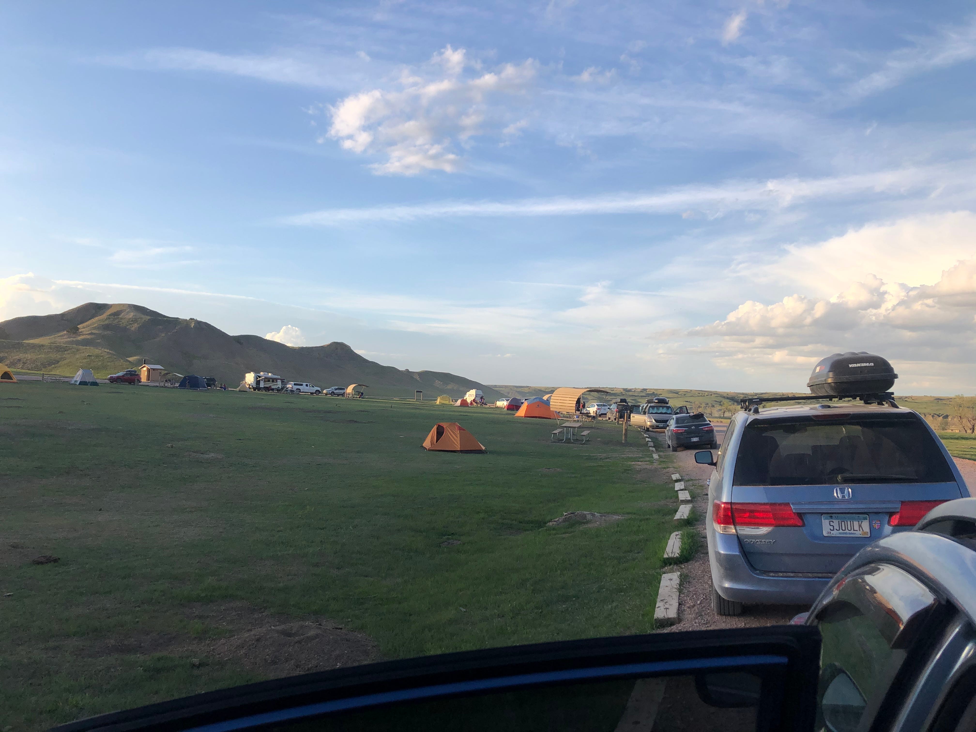
Five miles with tents, sleeping bags, and food on your back is longer on foot than by car, you realize, and grizzly hair has been shed on tree trunks near camp; but a bison stands guard by the Yellowstone River, and a full moon nestles in the V of the river valley. A wild, disc-shaped UFO turns out to have a certain Musk about it: a SpaceX Starlink satellite.

Places like The Hungry Bear, Rumble Creek, Liquid Louie’s, and Conoco hawk their wares along the highway en route to the Canadian border and Glacier National Park. Far enough north and the only people around are some shirtless teenage boys who stand around on well-used legs and fiddle with something inside the hood of a truck by the side of the highway. One of them takes a selfie in front of the greasy engine.
You pass Missoula, then need gas. Two older men rock in cowboy hats on the porch of an old-time convenience store with a DIY pump, watching you all the way.
You get to Glacier and balance atop the country for a brief, precarious moment:

You leave Glacier, head east parallel with the Canadian border in a 80 mph two-lane, and drive along a flat, unearthly, windblown tundra with not a building in sight, passing a car every five minutes or so. For many miles you can crane your head around, look back west, and still see Glacier in the surrounding grasslands: a host of gigantic snow-capped peaks disappearing into the clouds.
To the east of mighty Glacier: Blackfeet Nation. You enter Browning, the headquarters of the Blackfeet Reservation, and the first sight is of a dilapidated, low-lying brick structure with long grass out front. An old sign says, “Museum of the Plains Indian,” and another newer one says “Closed.” You wonder about a museum like that. It’s like someone showing you your own grave, but they haven’t bothered with the upkeep.
In a convenience store alongside windblown railroad tracks in a one-street town, still in the Blackfeet Reservation, a white dude behind the counter tells us there’s a $1000 fine for not wearing masks. The reservation rules are behind the national ones, he says, and rolls his eyes. We thought Biden had us covered, but there’s no knowing what locality you might roll up in.
South through Montana: Clear blue cloudless big sky, straight road forever, and semis ripping by with huge altarpiece grates bared gleaming. Good drivers in Montana, out of necessity.
Into Absaraka, the area of southern Montana and northern Wyoming that considered statehood, such was its awesomeness. In Billings there’s a Rosebud Creek, a Chief Dull Knife College, and a Burger Dive with a waitress who looks like Laura Palmer. All around, bloody history looms: the Battle of Bighorn, i.e., Custer’s Last Stand, i.e., the Battle of the Greasy Grass, i.e., the Battle of the Black Hills (depends who you ask). Buttes dot the landscape, affording views of great swaths of grass and more buttes.
The Hog Wild Café’s got some side pork (a thick fatty slab of bacon seasoned with heavy pepper) that’s to die for and the best toilet paper in the country. A man walks in alone, couldn’t “stir up” the regulars. He wears a tucked-in, plaid button-down, jeans, leather low tops, glasses, a pen and bundle in breast pocket, and circular glasses. He looks about seventy. Waitress greets him:
“Was your winter alright?”
“Didn’t fall down.”
“What can I getcha?”
“Three scrambled, sourdough – or can I get ummm I’ll get me an English muffin.”

The Midwest
I-90 goes straight outta Wyoming into South Dakota, and in Badlands you get the first hint of a smaller scale to things. A wind comes across the plains and it’s fresh and moist and you know where it comes from: the East. The highways are suddenly two-lanes, the speed limit stays at 70, and you have to brake sometimes. Familiar fast food chains throw their heraldry up to the sky…
~Intermission~
That’s all for now — I know, the suspense kills! Email size limits are a thing, apparently, so the next Dispatch will complete the loop east and south, square the circle, etc. Visions of America to be continued...
Until then,
DVD